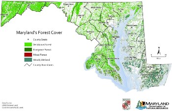
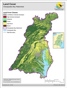
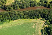
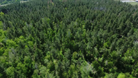
 To begin the forest resource planning process, local jurisdictions can identify the most important forested areas to protect. The following web resources include data, analytical tools and planning approaches for identifying these areas.
Urban Watershed Forestry Manual - Part 1 - Methods for Increasing Forest Cover in a Watershed (USDA; prepared by Center for Watershed Protection)
 This manual is part one in a three-part series on using trees to protect and restore urban watersheds. It presents methods to systematically measure watershed forest cover and to select the best methods for maintaining or increasing cover through protection, enhancement, and reforestation.
Maryland GreenPrint Map and MERLIN (Maryland's Environmental Resources and Land Information Network) Online (DNR)
The GreenPrint Map displays Targeted Ecological Areas (TEAs), lands, and watersheds of high ecological value that have been identified as conservation priorities by DNR. MERLIN is a resource for users to create customized maps including their choice of base maps and data layers to help make better informed decisions.
Maryland Strategic Forest Lands Assessment (DNR)
The Maryland Strategic Forest Assessment identifies forest lands with ecological, social and economic benefits. It also identifyies the planned management needed for the sustainable use of forest resources, including prioritizing commercial timber areas.
DNR Building Resilience to Climate Change Policy
 In 2010, DNR adopted the Building Resilience to Climate Change Policy to provide direction and guidance to the Department’s investments in and management of land, resources, and assets in the face of climate change. DNR developed evaluation criteria for all proposed State land acquisitions through Program Open Space as well as for Coastal Resilience Conservation Easements.
Maryland Rural Legacy Program
 Maryland’s Rural Legacy Area program provides funding to preserve large, contiguous tracts of land and to enhance natural resource, agricultural, forestry, and environmental protection while supporting a land base for natural resource-based industries. Local government and private land trusts identify the areas and submit competitive applications which are ranked based on the significance and extent of agricultural, forestry, natural, and cultural resources, threat from development, significance of historic and cultural resources, and the economic value of the resource-based industries or services (agriculture, forestry, tourism, and recreation).
Green Infrastructure Guide (NOAA) - Designating Forests to Help Limit Damage from Coastal Storms
The Green Infrastructure Guide provides a step-by-step process for incorporating green infrastructure strategies into a GIS workplan to rank and prioritize green infrastructure for coastal communities. Case studies, worksheets, and templates are provided to assist a community with designating forests to limit damage from coastal storms and the effects of climate change.
i-Tree: Tools for Assessing and Managing Forests & Community Trees
(U.S. Forest Service, Arbor Day Foundation, Society of Municipal Arborists, and International Society of Arborists)
This suite of free analytical desk and web application tools can be used to provide a wealth of data about which trees/forests are most important to be protected. One application can quantify the effects of tree canopy and impervious cover on water quantity and quality while another application can quickly assess human and forest population information and threats to direct tree planting and protection strategies.
Open i-Tree: Tools for Assessing and Managing Forests & Community Trees webpage
Forest Legacy Program
The purpose of the Forest Legacy Program, a U.S. Forest Service program, is to identify and conserve environmentally important forest areas that are threatened by conversion to non-forest uses. Maryland has designated specific Forest Legacy Areas within almost every county. The program, administered by DNR Forest Service, provides funding for forest conservation easements.