Land Preservation
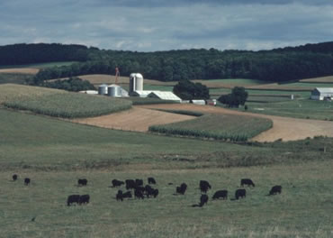
Key to limiting the loss of farmland and forest land are Maryland’s land preservation efforts, including funding for the Rural Legacy, Maryland Agricultural Land Preservation Foundation (MALPF) and Program Open Space (POS) programs.
The Maryland land preservation dashboard is designed to let you assess the current status of Maryland's land preservation efforts and to access the tabular data that informs the dashboard as well as available land preservation GIS data. Created in coordination with DNR and Planning's Geospatial and Data Analysis Unit, the dashboard incorporates data from local, state, federal, and non-governmental preservation programs. Click here to access the protected lands dashboard user guide.
The Maryland Department of Agriculture (Agriculture) joins Natural Resources and Planning to support land preservation through guidance for Priority Preservation Areas, which are identified in local comprehensive plans, and local Land Preservation, Parks and Recreation Plans.
Planning leads the administration of the Certification of Local Agricultural Preservation Programs (CLAPP) in coordination with MALPF. Created by the Maryland General Assembly in 1990, the CLAPP Program allows counties to keep more locally generated agricultural land transfer tax in exchange for creating effective local land preservation programs and continually evaluating and improving them. Program participation by interested counties is voluntary. Counties with an effective local agricultural land preservation program that wish to be certified must be approved by the MALPF Board and Planning.
In 2015, Planning created a Transfer of Development Rights Committee which included county executives, county commission presidents, and other representatives from counties that use Transfer of Development Rights (TDR) programs. Planning provides outreach, education, technical assistance, and analysis support to local TDR programs.
In 2021, Planning developed a standardized way for jurisdictions to submit their geographical information system (GIS) data to the Maryland Department of Natural Resources and Planning in order to conform to the Chesapeake Bay Program standard. Here is a link to the download for that GIS data standard which includes the new Planning Protected Lands geodatabase shell and a customized import model and guidance.
Rural Maryland Aspirations
The Rural Maryland Foundation traveled the state in four days asking rural Marylanders about their aspirations. This video shows their unscripted answers.

