Note: Tax Maps are not detailed maps of individual properties, nor are they "plats" or Location Drawings. Recorded plats are available at
plats.net or they may be filed with deeds at
mdlandrec.net. Location Drawings are not publicly recorded. Depending on your circumstances, you may need to consult with a professional land surveyor.
Paper Tax Maps 2’ by 3’ in size, or Digital .TIF and .PNG Tax Map Images
How Do I Order Tax Maps?
Paper tax maps are $25.00 per map, which includes processing, shipping and handling. If you order 50 or more, the price is $5.00 per map . Digital tax maps are $10.00 per map and are available in .TIF and .PNG formats. The images are not georeferenced; they include legend and border information.
Tax Map Ordering System
Digital (.TIF and .PNG) tax map images are sent via email. Paper copies of tax maps are sent First Class USPS mail at no additional charge.
About Tax Maps
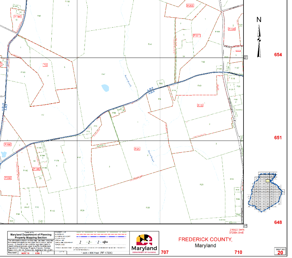
Example Section from a Paper Tax Map
Tax maps, also known as assessment maps, property maps or parcel maps, are a graphic representation of real property showing and defining individual property boundaries in relationship to contiguous real property. The primary purpose of these maps is to help State tax assessors locate properties for assessments and taxation purposes. Tax maps are also used by federal, State and local government agencies as well as private sector firms for a variety of analyses and decision making processes.
The Property Mapping Unit, part of the Maryland Department of Planning's Planning Data Research (PDR) division, is responsible for maintaining electronic tax maps and generating paper tax maps for the 23 counties in Maryland. For Baltimore City, MDP maintains a parcel point file and digital database of parcel polygons . The State's more than 2800 county tax maps are managed in a Geographical Information System (GIS) environment and updated using new property plats and deed changes obtained from the State Department of Assessments and Taxation (SDAT). The electronic tax maps form the foundation for many of MDP’s products and services, including MdProperty View, FINDER Quantum, and FINDER Online.
MDP’s Property Mapping Section has maintained tax maps for the Maryland State Department of Assessments and Taxation since 1996. New parcels and subdivision lots are added to each county set of tax maps, and each property in a county is linked to its corresponding SDAT assessments database record during the update cycle.
An Important Note about Town Maps
MDP’s paper tax maps are typically printed at a 600 feet per inch scale in non-town areas (400 feet per inch in Prince George's County), where parcels and lots are usually larger. In incorporated town areas, more detailed blow-up maps that show the smaller properties at a readable size are typically available at a 200 feet per inch scale. The properties included on these smaller scale maps are often not included on larger scale panels.
When using the online map, be aware of this difference when checking the county index map as you navigate your way around the county.
 Back to top
